findme
Table of Contents
Overview
- 176 solves / 100 points
- Overall difficulty for me (From 1-10 stars): ★★★★☆☆☆☆☆☆
Background
find the Coordinate ( be precise )
example : crew{19.3212,122.1235}
flag md5 : cbb510f471de8b8808890599e9893afa (example cmd: echo -n "crew{19.3212,122.1235}" | md5sum)
Author : st4rn
Find the flag
In this challenge, we can download a file:
┌[siunam♥Mercury]-(~/ctf/CrewCTF-2023/Misc/findme)-[2023.07.08|16:58:47(HKT)]
└> file chall.png
chall.png: PNG image data, 1920 x 963, 8-bit/color RGB, non-interlaced
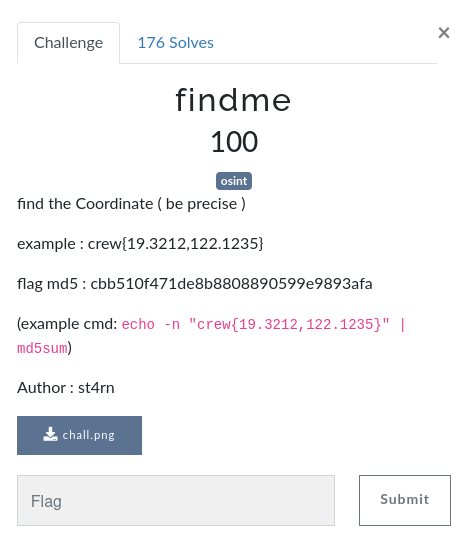
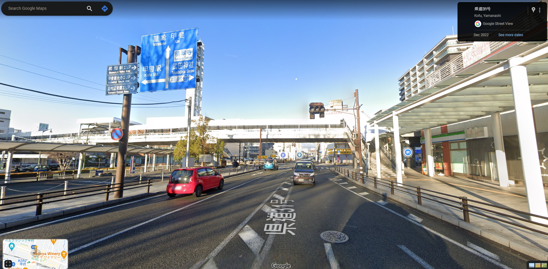
As you can see, it's a road somewhere in Japan. (As a Hongkonger, I can read traditional and simplify Chinese, as well as some kanji, so right off the bat I knew it's in Japan.)
During doing OSINT in finding a place, I always take a note of some characteristics of the picture:
- Tall building on the top left
- 2 road signs, 1 is brown, 1 is blue
- It has an overpass, stair is on the right side
- It has a shelter map on the left side (避難場所)
- It has a mountain in the middle
Armed with the above information, we can start finding the abstract location of the picture.
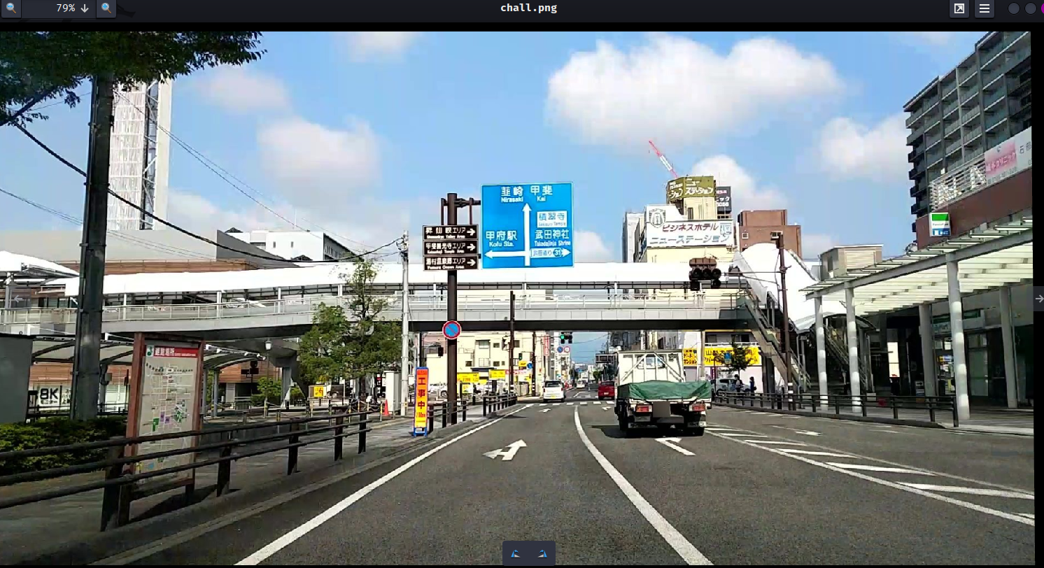
First, I wanna search where 甲斐 is:
As you can see, there's mountains on the west side:
Therefore, the picture's location is somewhat near 甲斐.
Then, I started looking for the tall building, and I found this:
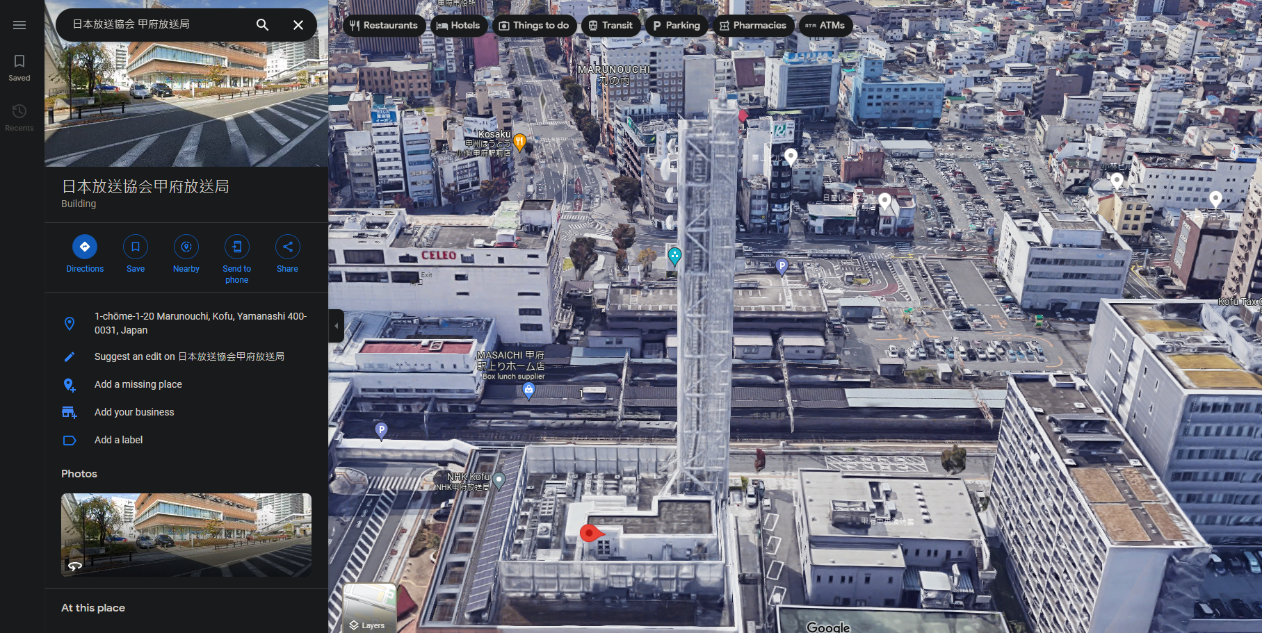
Which looks very similar to the picture's one.
Then, I found the blue road sign:
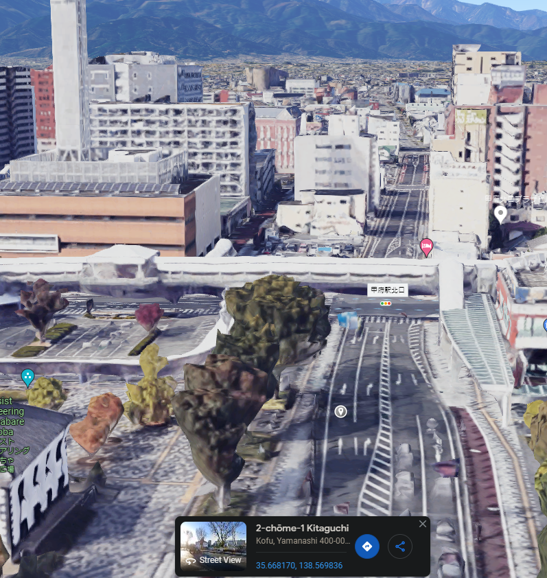
Nice! We found the correct location!
However, I couldn't find the exact coordinate, so I brute forced it lol:
#!/usr/bin/env python3
from hashlib import md5

if __name__ == '__main__':
    targetFlagMd5 = 'cbb510f471de8b8808890599e9893afa'
    latitude = '35'
    longitude = '138'
    try:
        for latitudeDecimal in range(6600, 10000):
            for longitudeDecimal in range(5000, 10000):
                coordinate = f'{latitude}.{latitudeDecimal:04d},{longitude}.{longitudeDecimal:04d}'
                flag = 'crew{' + coordinate + '}'
                hashed = md5(flag.encode('utf-8')).hexdigest()

                print(f'[*] Trying coordinate: {coordinate} ({flag}). Hashed: {hashed}', end='\r')
                if hashed == targetFlagMd5:
                    print(f'\n[+] Found correct coordinate: {coordinate}. Hashed: {hashed}')
                    exit(0)
    except KeyboardInterrupt:
        print('\n[*] Bye!')
┌[siunam♥Mercury]-(~/ctf/CrewCTF-2023/Misc/findme)-[2023.07.08|17:36:10(HKT)]
└> python3 solve.py
[*] Trying coordinate: 35.6682,138.5699 (crew{35.6682,138.5699}). Hashed: cbb510f471de8b8808890599e9893afa
[+] Found correct coordinate: 35.6682,138.5699. Hashed: cbb510f471de8b8808890599e9893afa
- Flag:
crew{35.6682,138.5699}
Conclusion
What we've learned:
- Finding Location Via OSINT